
The Ark Disclosure – Part 2
Written by Goro, May 13, 2021
[Continuing from Part 1…]
Reality check: Not to sound grandiose, but sometimes reminders are helpful. Do you realize that in the entire history of (known) human civilization, YOU are among the very first (excluding the “hidden ones”) to learn the truth about the Great Flood, Noah’s Ark, Eden, Giza monuments, Atlantis, etc.?
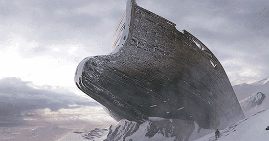
People have spent millennia searching for real answers to such huge ancient mysteries. And here we are in the 21st century in this little place called Super Torch Ritual… the surprising answers are finally being disclosed for the first time in “history”. The “map of time” is only allowed to come out right before the end. Here we are at the edge of forever at the beginning of Time Wars. Let the Endgame begin? Anyway…
Mount Ararat…
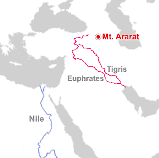
…where Noah’s Ark is believed to have landed after the Great Flood in Christian tradition. (It’s actually “mountains of Ararat”, not “Mount Ararat”.)
Notice in the map how the Euphrates “comes” from the direction of the Ark/Ararat, as if to imply “this is the timeline or bloodline descending from ‘Noah’ and/or ‘fallen angels’ that survived the Flood”.

Philostorgius, one of the oldest sources identifying Mount Ararat with the place of descent, was quite explicit in highlighting the source of the Euphrates. Quoting his statement as epitomized by Photius:
As for the Euphrates River, it appears to take its rise in Armenia, where Mount Ararat is. The mountain is still called by that name by the Armenians. It is where, according to scripture, the ark came to rest, and they say that considerable remnants of its wood and nails are still preserved there. From there the Euphrates starts as a small stream at first, growing ever larger as it advances and sharing its name with the many rivers that empty into it.
Via the Time Rivers (unearthed by yours truly), we can bring precision into the whole thing, which is one of the hallmarks of something being true and real.

It’s all in the “Eden overlay configuration” which identifies the 4 rivers of Eden as the Euphrates, the Tigris, and then to most people’s surprise, the Blue Nile and the Atbara rising in Ethiopia, both of which are tributaries of the Nile responsible for the world’s biggest’s river’s annual flood (without which ancient Egypt wouldn’t have existed).

They are designed to interact as overlays (using longitude 33°E as the anchor meridian) and essentially designed to mimic each other, i.e. Euphrates = Blue Nile and Tigris = Atbara. (Check out this post if you want to find out just how eerily precise this overlay interaction can be.)
It’s no coincidence that the location of Eden is roughly the same as the Ark’s place of descent – both around the source of the Tigris-Euphrates. Two timelines/bloodlines descending from the “survivors of the Flood” which you can call “Noah” and/or “fallen angels”. Two factions. But that’s for another time.
In Part 1 we explained how the Ark as a cube is a geometric reference to the peak of the Nile’s great “arc” (bend) exactly at latitude 19.5°N – exactly where the transposed overlay of the Euphrates “touches” the Nile:

As you can see, for the Euphrates this special latitude 19.5°N corresponds to 39.6°N, i.e. the latitude before the transposition. It closely matches the latitude of Mt. Ararat, 39.7°N, and matches with precision the angle of the Great Pyramid’s “Sirius star shaft” extending from the so-called “Queen’s Chamber”.

The Sirius alignment was most precise around 2350 BC, hence the anchor date assigned to latitude 19.5°N on the Nile timeline.

Apart from Mount Ararat, there is also Mount Judi where the Ark is said to have landed according to very early Christian and Islamic tradition.
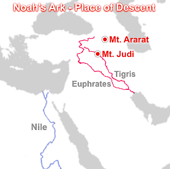
It’s exactly where the transposed Tigris river crosses the Nile!
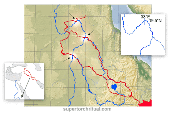
Again, keep in mind that these Nile tributaries are/were literally responsible for the Nile flood which ancient Egyptians saw as the resurrection of Osiris, triggered by the heliacal rising of Sirius.
Sumer – popularly considered the earliest human civilization i.e. directly after the Flood” – rose between the two rivers around 4000 BC in southern Mesopotamia (Eden)… exactly where Lake Tana ends up in the overlay scheme…

…which is the most visible source of the Blue Nile, the biggest water source for the Nile inundation. The Blue Nile joins the main Nile at Khartoum at 15.6°N, corresponding to 4000 BC on the Nile timeline, precisely matching the birth of Sumer! It’s not the “land of the Watcher” for no reason. You can clearly see in this literal map of time a “time portal” – a “Stargate” – and that some form of “time travel” was involved.

It is what I call the “extra-historical time injections“. Don’t waste your time focusing too much on UFOs and bug-eyed ETs (though certainly fascinating). That’s more for kids at this point. This – the map of time – is where the real action is or will be, revealing all about our place in the cosmos and spacetime continuum.

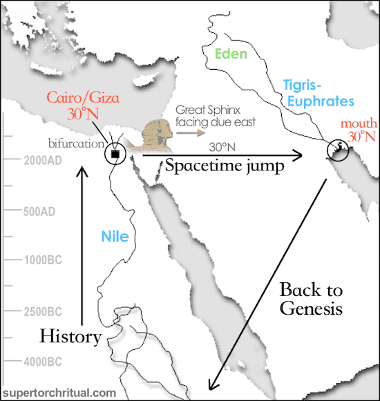
And the Hall of Records has only begun to open. This is the beginning of reality’s endgame.

Ready for an information Great Flood?


Time Rivers – A Map of Time From the Garden of Eden
May 23, 2020 It Was Us
May 24 Extinction-level time shift
Jun 17 Stargate at 30°N
Sep 17 Extra-Historical Time Injections
Sep 29 The Time Flip